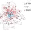
Simply moving back and forth between an historical map of Atlanta and a current map is a visceral experience.
As neighborhoods fade into interstates, stadiums, or runways it’s hard not to gasp. Maps have long been a tool for the powerful to create the future. Lines on a piece of paper become roads, walls, parks, buildings. The ATLMaps project attempts to make these processes more transparent and allow citizens to examine past decisions and add their own stories to these maps. Many city maps are in archives open to the public, but they have often been fragile, unwieldy, and difficult to find. Digitizing these documents has made them more accessible, but most people still don’t know how or why to access them. Our platform makes the thousands of historical maps in Georgia State and Emory University’s collections more understandable, locatable, and useful. Users can search for and layer these documents, and combine them with photos of the city, walking tours, oral histories, and art projects.
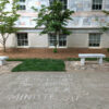
The goal of Emory and GSU’s ATLMaps platform is to create a clearinghouse of geospatial data about Atlanta, allowing users to create deep maps that show complex connections over time and between different subjects. For example, the Stadiumville project explores the connection between the 2013 Living Walls cluster of murals next to Turner Field and the city’s decisions decades ago to knock down neighborhoods to build stadiums, interstates, and parking lots. We also have layers of photos that show some of Atlanta’s most impressive buildings of their day according to the 1898 Hand Book of the City of Atlanta: A Comprehensive Review of the City’s Commercial, Industrial, and Residential Conditions and the 1907 Atlanta Standard City Guide: A New and Complete Handbook of Atlanta with Map, Panorama, and 80 Views. How many of these once significant are parking lots today? And after listening to the recordings in our layer plotting Tim Crimmins’ audio commentary on historic Atlanta locations (which you can see to the right), you can never look at the Candler building the same way. Over the next few weeks, Atlanta Studies will publish blog posts introducing new ATLMaps layers as well as reflections on some of our older layers, including a geology walking tour of downtown building materials, a map of two Art Papers articles, and data from the Home Owners’ Loan Corporation that led to the practice of redlining. On September 12th at Manuel’s Tavern, we will have a meetup showcasing some of these layers and introducing new features on the site.
This event and publication series coincides with the rollout of a new version of the site allowing any user to create an account mash-up layers, explain the significance of these groupings through videos and text, and save a project to take into a classroom or a neighborhood meeting. Moreover, sharing layers and projects is now easy and intuitive with our newly added layer links and embed functionality. Users cannot upload new layers on their own yet, but we are happy to work with teachers, researchers, journalists, and community groups on a case-by-case basis to add their data and maps to the platform. We hope that these new features encourage users to explore Atlanta and tell their stories of the city, eventually creating their own maps and projects.
Adding more content to the site will be one of our missions as we move forward. Along with user-generated content, we plan on working with the Atlanta Regional Commission and Neighborhood Nexus to add more city data to the site. This will allow users to layer archival maps over contemporary information on the local economy, health outcomes, and environmental data to explore how the city’s past is connected to its present and future. Our challenge will be to continue to make the site usable for everyone as the complexity and amount of data increases.
Citation: Collins, Brennan. “ATL Maps: Mapping the Stories of Your City.” Atlanta Studies. September 05, 2017. https://doi.org/10.18737/atls20170905.


